Software products
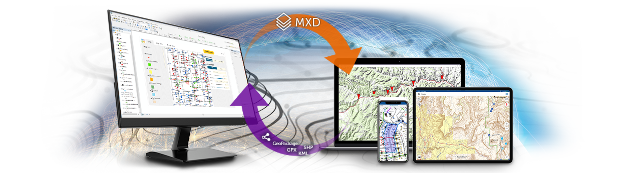
Extension to ArcGIS Desktop to export your ArcGIS map documents to mobile maps for further use on iOS, Android, and Windows devices, not tied up by internet availability. Access to mobile maps can be limited, and options of customizing identification cards and adding various branding details allow to make them recognizable and personalized.

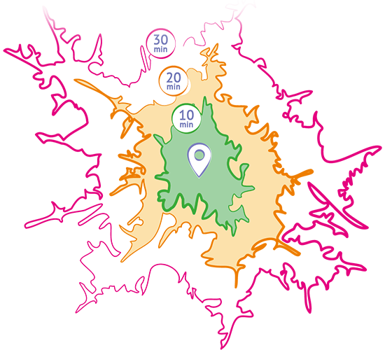
A software product for performing network analysis on road network. With TrueDrive you get a set of powerful calculation methods to conduct different marketing researches and to optimize business processes saving time for decisions making.
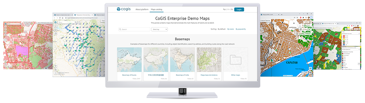
Own geoinformation platform provided to create and publish cartographic web apps allowing for geodata editing and analysis.
Complex software solution provided for 3D visualization, effective management, and control of the quality of geodata related with wellbore drilling. Automation of exploration and survey works via 60 spatial data processing and geoprocessing tools.

Powerful tools and functions for spatial analysis, shape conversions, and table management in ArcGIS Desktop and ArcGIS Pro. Thousands of users worldwide successfully apply XTools Pro functionality solving different GIS tasks in their everyday work. XTools Pro tools are used across many industries including major Fortune 500 companies. Not tighten to any specific field XTools Pro is for everybody who uses ArcGIS in their everyday work.
XTools Pro tutorials on YouTube

Extension for spatial analysis of results of agricultural lands inspection. AgroKarta functionality has been developed based on regulatory documents applicable in the agrochemical industry and requirements from federal management bodies.

ArcGIS Plug-in Data Source allowing direct reading of MapInfo TAB and MIF/MID files in ArcGIS preserving symbology and rendering properties, attributes and information about coordinate system. The option of viewing and direct reading of TAB files and MapInfo workspaces in ArcCatalog, as well as exporting feature classes to TAB files provide tight integration of MapInfo data into ArcGIS environment.